|
Brightwood Park History
|
History of Brightwood Park
A history in pictures of Brightwood Park in Westfield NJ, compiled by Robert Lombard
|
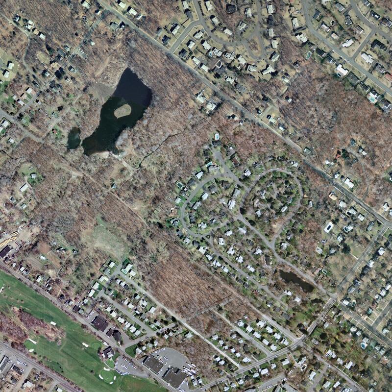
1979 aerial picture of Brightwood Park
|
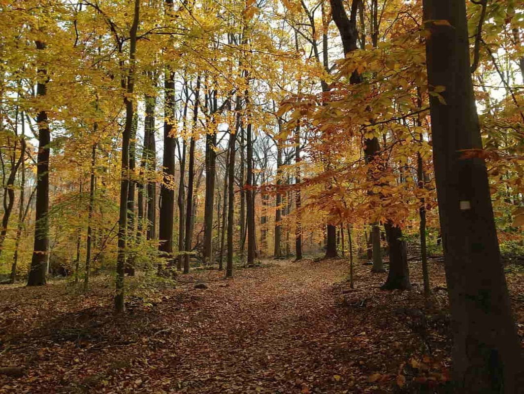
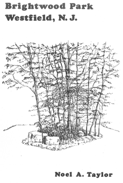
The Transition of Turkey Swamp and The Big WoodsBrightwood Park in Westfield opened to the public in 1980. Located in the northwest corner of Town, the Park is approximately 43 acres in size, today a mostly wooded area that features two ponds and nearly two miles of trails.
It was dedicated as a passive park, due in large part to the efforts of Noel Taylor, a science teacher at Westfield High School, who had vigorously campaigned to keep the Park in its natural setting. But before it became a Park, this area of the "Big Woods", sometimes called Turkey Swamp, was home to a neighborhood of mostly African-American families, some of whom lived there for nearly 60 years. When you stand in the Brightwood Park parking lot today, you are standing on the old Liberty Street - in the heart of what a once lively neighborhood. |
2024 ToursSaturday, April 27
Saturday, May 4 Saturday, June 8 Saturday, September 14 Saturday, October 12 10 AM to noon |
We will meet at the Parking Lot for Brightwood Park. If rain is predicted and the scheduled tour is cancelled, rain dates will be the next day Sunday at 1:00pm to 2:45pm.
|
1880 to 1900
|
1900 to 1920
Westfield is Growing
|
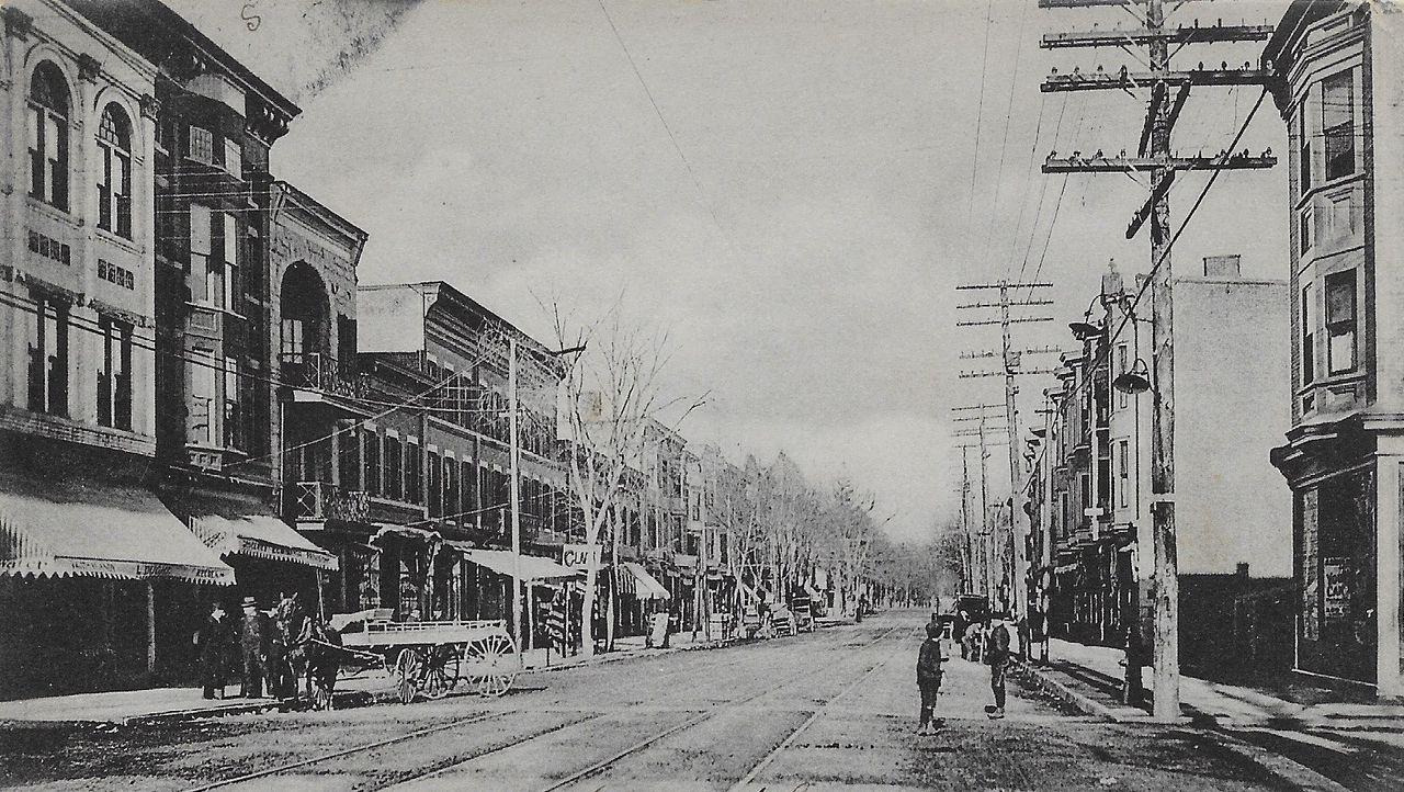
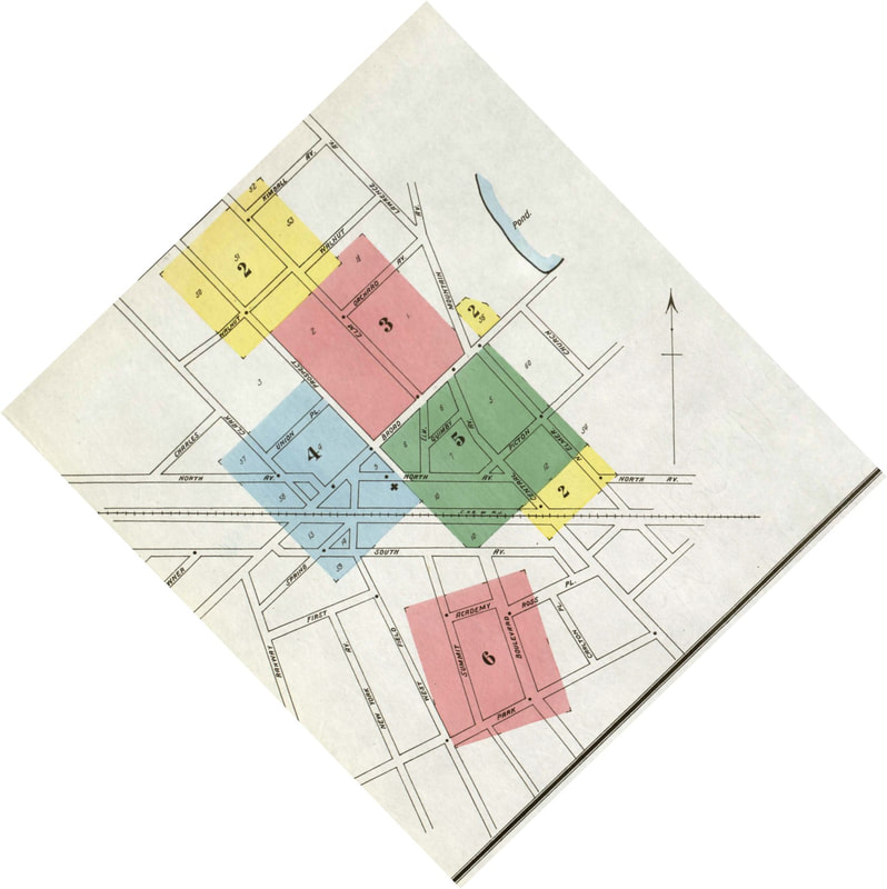
The 1901 Sanborn map of Westfield is shown at left. By then, the Town’s first water and sewer mains, streetlights, and sidewalks had been installed in some of the downtown area. The train station was transporting 400 commuters daily, and a new streetcar, or trolley line, had connected Plainfield and Westfield, and work was underway to connect the trolley to Elizabeth.
|
|
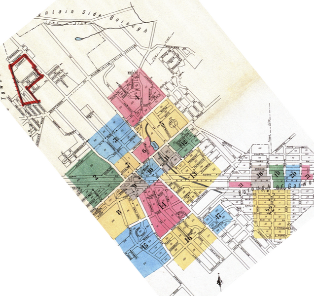
By 1910, the pace of growth in Westfield was accelerating, as is documented on the left by the 1909 Sanborn Map of Westfield, showing development to the north beyond Dudley Avenue and south beyond Grove Street. The future site of Brightwood Park is outlined in red.
|
|
|
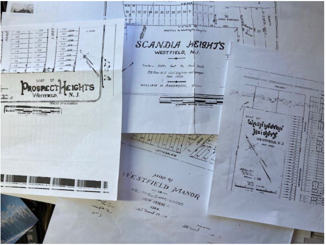
“Turkey Swamp” was purchased and subdivided into 340 residential lots by at least six real estate businesses and/or builders.
Ironically, many of the realtors/developers who purchased and subdivided the site were themselves either immigrants, first generation immigrants, or US residents who had migrated from other areas of the Country, just as the future purchasers and residents would be.
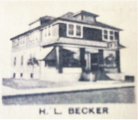
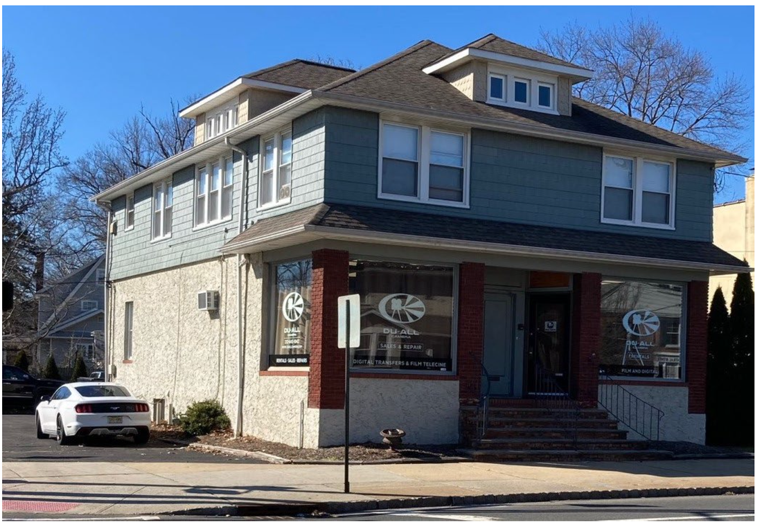
As an example, the mother of Clark Perrine, the subdivider of Washington Heights, was born in Ireland; William H. Anderson, the subdivider of Scandia Heights, had only arrived with his wife in 1888 from Norway. Hjalmar Becker and his wife, Hulda, arrived in New York from Sweden in 1903. He was selling lots in the Scandia Heights subdivision in 1905, and would eventually expand his real estate enterprise throughout all of Westfield. John Davis, the subdivider of Marlborough Slopes, had migrated to Brooklyn and then to Scotch Plains from Oswego, New York. The price of a lot in the subdivided site varied from $20 to $100 between 1905 and 1920. The lots were purchased by individuals hoping to eventually build a house and others who simply wanted to profit from their investment. They were advertised in African-American oriented newspapers to New York City residents, and sold to individuals as far away as Haverstraw, New York. By 1920, the majority of purchasers who built homes on their lots were African-Americans. About two thirds of the 27 homes built were originally owner-occupied and the rest were rented to mostly African-Americans. All except three of the African-American occupants had come north from Southern states along the Atlantic Coast, and were part of the Great Migration by African-Americans to the North seeking a better future for themselves. The "paper streets" were dirt paths at best, and there was no sewer or water service, so residents relied upon wells and outhouses. |
A few homes are built in the Turkey Swamp/Jerseyland Area
|
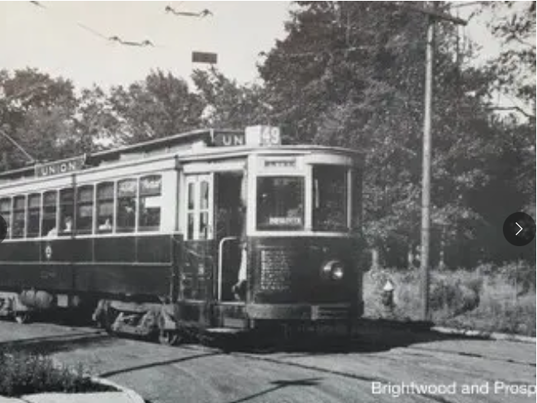
The trolley route from Plainfield followed Brightwood Avenue to Prospect Street, then Elm Street to the town center.
Its stop at the Westfield Golf Club near Jerusalem Road was within easy walking distance from Turkey Swamp. Perhaps the proximity of the trolley line to Turkey Swamp may explain why residential subdivisions occurred and homes constructed there before 1910, far from the Town center and train station and well beyond the Town’s outward residential growth pattern, as shown in the Sanborn maps. |
JerseylandTurkey Swamp was part of the “Big Woods”, a mostly undeveloped, wooded area with small tracts of farmland bounded by Lawrence Avenue, Brightwood Avenue and the border with Scotch Plains, which was then known as Fanwood Township.
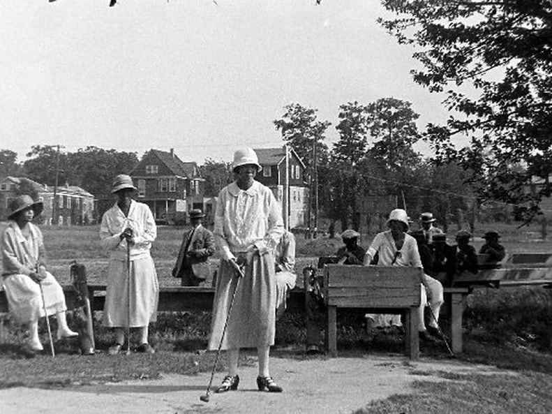
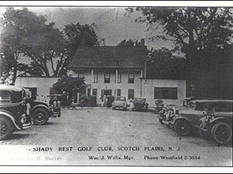
On the Scotch Plains side of the border, Jerseyland, as it came to be called, was a racially integrated community, which existed along Plainfield Avenue and Jerusalem Road and side streets. Over time Jerseyland eventually would be home to the Shady Rest Country Club, the Jerseyland Colored Community Park, St. John’s Baptist Church, and Metropolitan Baptist Church. So these contiguous areas – one in Scotch Plains, the other in Westfield – would evolve in the early 20th Century as one community. |
Community LifeAccording to US Census reports and obituaries, residents worked in various service occupations – peanut vendor, servant in a private home, janitor, hotel porter, gardener, barber, cook, laborer, railroad worker, etc.
They were active in social clubs like the Elks and Masons. Many performed significant roles in support of St. Thomas A.M.E. Zion Church on Fanwood Avenue and eventually Metropolitan Baptist Church and St. John’s Baptist Church in the Scotch Plains section of the neighborhood. Most were married, and most couples had children. At the outbreak of each World War, male residents signed up for the draft, and many served during the two wars. |
1930 to 1940
The Great Depression
The Great Depression affected everyone in America and certainly impacted Westfield’s robust population growth.
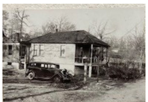
From 1930 to 1940, no new home construction occurred on the site of the future Brightwood Park. It is also likely that the lack of paved roads, water and sewer services made the neighborhood less attractive to home buyers, and the number of resident homeowners declined.
From 1930 to 1940, no new home construction occurred on the site of the future Brightwood Park. It is also likely that the lack of paved roads, water and sewer services made the neighborhood less attractive to home buyers, and the number of resident homeowners declined.
|
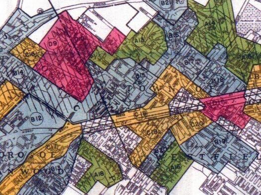
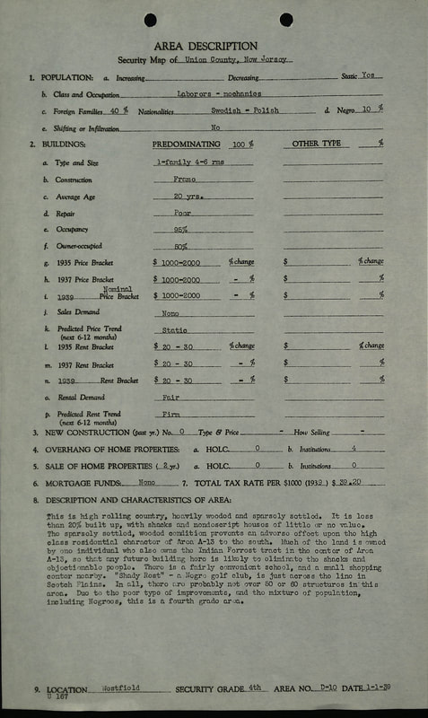
As you can see from this 1939 HOLC mapping of the Westfield area, both the Jerseyland neighborhood (Map D9) in Scotch Plains and the Turkey Swamp neighborhood (Map D10) were included in the “D” category, as well as a small, racially integrated section on the north side of Prospect Street. The only other area in Westfield given this ranking was the neighborhood around Cacciola Place.
|
Home Owner's Loan Corporation Redlines the Turkey Swamp NeighborhoodBy 1932, the effects of the Great Depression were setting in. Across the Country, 20% of mortgages were in default, banks had closed, and housing construction collapsed. In response, the Federal Government created the Home Owner’s Loan Corporation (HOLC) meant to rescue homeowners and lenders from mortgage default, and the Federal Housing Administration (FHA), intended to provide lower mortgage interest rates through federal guarantee of new mortgages. However, these programs also established written standards for loans which included ranking neighborhoods based on wealth, home condition, sales trends, and race. Both programs viewed racially integrated neighborhoods negatively. The Turkey Swamp neighborhood was evaluated as a “D” or “hazardous” area by the HOLC mapping in 1939. The “D” rated neighborhoods were colored in red on the Federal maps, which years later would prompt the term “redlining”.
The impact of this assessment would prevent the property owners in Turkey Swamp from obtaining mortgage financing through either of these Federal programs. And it undoubtedly influenced the opinion of local officials and the real estate sector about the neighborhood.
|
1940 to 1950
Turkey Swamp Struggles. New Developments Appear in the Surrounding Area
|
By 1940, the Turkey Swamp neighborhood was surrounded by new development which had paved roads, and water and sewer mains to support indoor plumbing, whereas the 25 homes on Liberty Street, Fanwood Avenue, Netherwood Avenue and Smith Street had rutted, dirt paths for roads, wells for water, and outhouses for sanitation.
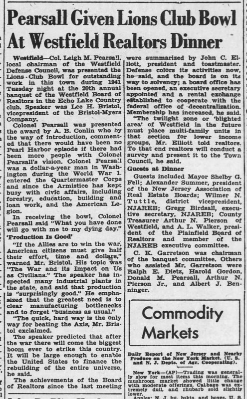
Perhaps the saddest irony that highlights the disparity in services to neighborhoods is that Plainfield-Union Water Company installed new water transmission mains in Netherwood Avenue in the 1940s and in Liberty Street in the 1950’s, which were directly in front of many of the residents’ homes, but no water service was provided to their homes. Surrounded by New Development, the Turkey Swamp Neighborhood is declared "blighted"It's possible that the negative ranking by Federal officials and the notable difference in what were by then considered essential services influenced the President of the Westfield Board of Realtors to announce in 1942 “The twilight zone or ‘blighted area’ of Westfield in the future must place multi-family units in that section for lower income groups. To that end, realtors will conduct a survey and present it to the Town Council”.
The Board submitted its report to the Town in 1943; it included photographs of all the homes in Turkey Swamp, and proposed to replace the individual homes through rezoning the area for apartments. Future newspaper accounts confirm that rezoning the Turkey Swamp area for apartments would be talked about by Town officials and community leaders for ten years, but the rezoning did not occur. |
1950s, 1960s and early 1970s
Westfield Begins to Consider Using the "Big Woods" for Township Purposes
|
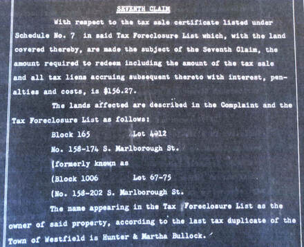
Between 1951 and 1956, 99 lots within the Turkey Swamp neighborhood were acquired by the Town via foreclosure for non-payment of taxes; and none would be sold. It marked the beginning of an effort by the Town to assemble this part of the “Big Woods” for Township purposes.
In the late 1950’s, a planning consultant was hired by the Town to evaluate two sites for a possible park – one was the neighborhood of Turkey Swamp, and the other site was east of Springfield Avenue near present-day Lenape Park. The consultant recommended the “Big Woods” site, as it would be less costly to the Town and was closer to the Town’s population center. |
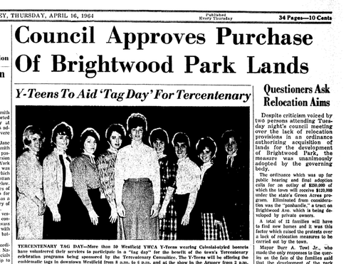
Public discussion of the possible acquisition of the entire site appeared in the Westfield Leader in 1961. In 1964, The Westfield Town Council authorized the acquisition of the privately-owned properties for a new park.
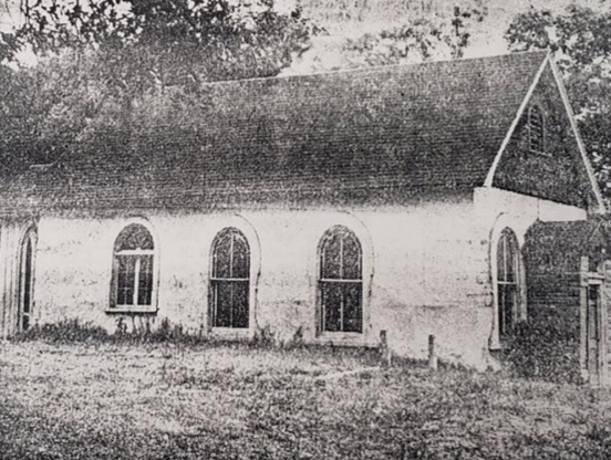
By 1970, most private parcels were acquired through negotiated sale; six parcels were acquired through condemnation, including St. Thomas AME Zion Church, the portion of of Jerseyland Colored Community Park which was within Westfield, and several African-American homeowners who had refused to sell. Two homeowners – Samuel Jarvis and Cordelia Manair, were granted lifetime occupancy.
By 1970, most private parcels were acquired through negotiated sale; six parcels were acquired through condemnation, including St. Thomas AME Zion Church, the portion of of Jerseyland Colored Community Park which was within Westfield, and several African-American homeowners who had refused to sell. Two homeowners – Samuel Jarvis and Cordelia Manair, were granted lifetime occupancy.
70's, 80's 90's 2000's
Related Information and Organizations
Preserve Shady Rest CommitteeThe mission is to preserve and restore the historical significance of the Shady Rest Clubhouse at Scotch Hills Country Club. Submit to the National Register of Historic Places Nomination for review by the New Jersey Preservation Office to historically solidify Shady Rest’s landmark in history; to educate and present the rich history of Shady Rest and John Matthew Shippen, Jr. To create a multi-purpose center and museum to display memorabilia, photographs, artifacts, and oral stories of the Shady Rest and John Matthew Shippen, Jr.
|
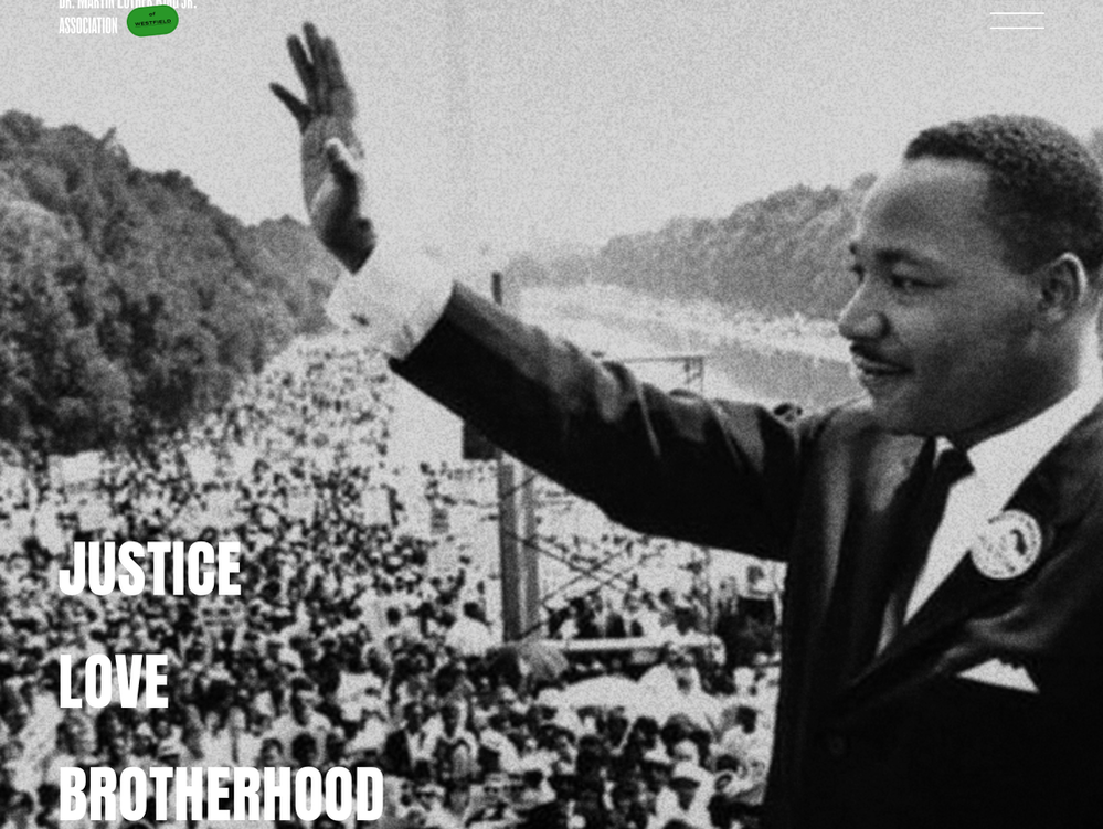
Martin Luther King Association of WestfieldThe mission of the Dr. Martin Luther King, Jr. Association of Westfield is to keep the memory of Dr. King alive by focusing the community on the important tenets from the words and life of Dr. King. To achieve this mission the Association will annually sponsor an Interfaith Commemoration Service that will uphold and emphasize these tenets.
The Association will endeavor to further Dr. King’s message through other activities that will encourage children and families to practice the principles of justice, fairness, brotherhood, and non-violent community action espoused by Dr. King. |
Westfield Historical SocietyOur mission is to preserve, interpret, and encourage interest in history, Westfield, and its residents through educational efforts and community outreach programs.
The Westfield Historical Society is based in the Reeve History & Cultural Resource Center, located in an 1870s home at 314 Mountain Avenue in Westfield, New Jersey. The Society also owns the Miller - Cory House Museum located at 614 Mountain Avenue. The circa-1740 Miller-Cory House was acquired in 1971 and is operated as a “living museum”, staffed by Miller-Cory House Museum volunteers. |
some additional references
It was the center of African-American society in N.J. Locals say we need to preserve it; nj.com, February 16, 2020

